I’m going to jump the gun and predict some good migration tonight. It seems like there’s a line of convection to our west that is expected to keep the southerly winds moving along the coast, and a warm front making its way north, possibly opening the backdoor to some migrants along the mid-Atlantic. There’s also a chance of some precipitation early in the morning, so this might just be what we’re waiting for in terms of concentrating migrants. It’s too early to tell, since the sun has only just set, but I’ll post the radar later tonight and try and get a better handle on it. In the meantime, you may want to pack some light rain gear and anticipate a morning pilgrimage to your favorite spot. 🙂
Okay, here we go!
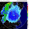
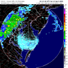
Here are two radar streams. One from Norfolk, VA where you can see migration is well in effect. The other is from Dover AFB in Delaware, where at the end of the loop you can see birds entering the radar from the south. The trough is visible to the west, and you can see how it’s funneling birds up the east coast. This is going to send birds right up into New Jersey for tomorrow morning, for sure! The warm front can be seen across central NJ and moving north. Fog is expected for morning, coupled with spotty precipitation, making conditions good for some migration grounding. I think coastal sites from Cape May north to wherever the warm front finally settles should be productive. The warm front appears to be moving far enough to clear Garret Mountain, so that would be a good bet as well. I’ll try and post a late radar from New Jersey, but no matter what, you should GO BIRDING!
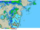
Here’s the last little radar tidbit for the night. This is a regional composite showing the Delmarva up to and including New Jersey, New York and points north. Watch as the birds get funneled up between the frontal boundary to the west and the Atlantic to the east. This is truly awesome. The reason we get such a spectacular radar show is because most of the migrants in New Jersey left last night (see last nights radar if you don’t believe me!). Nothing moved over New Jersey immediately after sunset, making for a dramatic entrance once the birds from the Delmarva began moving through at about 10:00pm. Remember last night the front was stalled south of the Delmarva, precluding any birds from migrating up into New Jersey…well, not tonight!!! It’s already pretty late, so I’d say south Jersey is the place for tomorrow. Northern bay shore and Cape May being prime. Birds will definitely make it all the way up the state by first light, but I think the density will be highest in the south. Scratch that last part, birds are already hitting north Jersey. All migrant hotspots should be checked tomorrow.


One response to “Well, who would have predicted…”
I’m convinced now that my backyard is NOT a migrant trap. Although bird activity was high on my 40 minute walk around the property, most was due to local breeders. Lots of Towhees, Field Sparrows, Chipping Sparrows, WB Nuthatches, Brown-headed Cowbirds, and Am. Goldfinches.
The morning radar looks as if birds did eventually disperse over NJ. They seem to have done so about an hour before sunrise, I’m assuming some of that was due to building fog. I look forward to today’s reports.