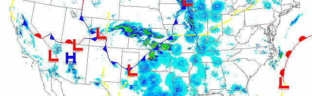
National overview
Migration was hot and heavy from Michigan to Texas, along the most recent cold front to move across the Central US. Migration was evident across New England, the Great Lakes Region, the Gulf Coast from the Florida Peninsula to the Texas/Mexico border, and across the Desert Southwest and up the Pacific coast into the Pacific Northwest. You can tell just from the extent of migration that we’re really getting into the swing of spring!

Below are the radar loops from sunset last night through 5:00am (central time) this morning
Upper Midwest
Minnesota & Wisconsin
Frames are every 1/2 hour. click on the thumbnail to view the full-sized animation.


Heavy precipitation (including accumulating snow!) kept birds from migrating into or out of the northwest portion of our forecast area. This includes both the Twin Cities and Duluth areas. You can see from the velocity images that the winds were pumping out of the northwest which just added to the poor migration conditions.


Moving east, though, migration quickly begins to dominate the radar images. Moderate to heavy migration was apparent across most of Wisconsin southeast of the frontal boundary, approximately from La Crosse to the Door Peninsula. Looking at La Crosse we see some migration after sunset that is quickly overtaken by precipitation. Some birds appear to continue moving as the front passes over but most do land because of it. After the front passes there was another small pulse of birds on the backside of the precipitation, but they too landed soon thereafter. Looking farther east we see moderate to heavy migration (20 to 25 dBZ) over both Milwaukee and Green Bay with most birds heading NW at the early end of the migration event. As the front reaches the Lake Michigan coast and winds turn more southwesterly, birds begin to push toward the shoreline where they will likely be piled up a bit this morning. A pulse of birds transited the lake and arrived from Michigan early this morning on the Green Bay radar, the bulk of which will have made landfall on the Door Peninsula today.
Iowa & Illinois
Frames are every 1/2 hour. click on the thumbnail to view the full-sized animation.


Again, another good push of birds into Southern IA and IL with the heaviest migration occurring in the eastern part of the region due to the position of the frontal boundary. The Chicago radar indicated NW movement early in the migration event, switching to ENE movement by morning also suggesting some piling up along the lakefront this morning.
Birding conditions should be optimal along the Lake Michigan shoreline this morning, up on the Door Peninsula, and in and around Green Bay. New birds should be present throughout the southeastern two-thirds of the state as well today although most likely will be well dispersed across the landscape at inland sites. The Northwest region will have to wait for the heavy precipitation to clear out before any major influx, but the good news is that’s only a few days away!
As always, woodcreeper.com depends on you to report your sightings and be our ‘eyes on the ground’, so please come back and give us an idea of how we’re doing predicting birding conditions in your neck of the woods.
Good Birding,
David
For migration updates in other regions check-
Michigan’s Upper Peninsula -Â The Northwoods BIRDARÂ by Max Henschell
New England -Â Tom Auer’s blog
Florida/SE - Badbirdz Reloaded by Angel and Mariel Abreu
PA/Ohio Valley - Nemesis Bird by Drew Weber
NW Ohio - Birding the Crane Creek by Kenn Kaufman
Pac NW - Birds Over Portland by Greg Haworth
Continental US - eBird BirdCast Forecast & Report by Team eBird