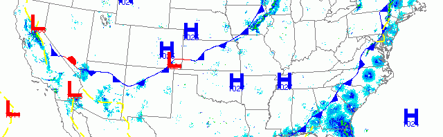
National overview
As the latest cold front pushed east to the Atlantic, migration was heaviest right along the Eastern Seaboard. Southerly flow over the Florida Straits and Gulf of Mexico also brought a pulse of Caribbean, Trans-Gulf and Circum-Gulf migrants into the Lower 48 last night. Migration continued on the Left Coast as well, with heavy radar returns evident from the Desert Southwest, Great Basin, and Central Valley of California up through the Pacific Northwest. High pressure across the Great Plains and Midwest, however, kept most grounded over the region last night.

Below are the radar loops from sunset last night through 5:00am (central time) this morning
Upper Midwest
Minnesota
Frames are every 1/2 hour. click on the thumbnail to view the full-sized animation.


While surface winds were light and westerly, upper-level winds from the northwest coupled with precipitation appear to have kept birds down over most of the region last night. Both the Duluth and Twin Cities radars indicate a small amount of northeast-bound migration last night, but again, it was minimal at best. Things are about to heat up over the region, but we’ll have to wait another night until the floodgates really start to open up.
 Wisconsin
Frames are every 1/2 hour. click on the thumbnail to view the full-sized animation.


The situation for Wisconsin was similar to that for Minnesota, only a small pulse of northeast-bound migrants were apparent on all three of the Wisconsin radars last night. Expect some localized shuffling of the deck, but otherwise similar conditions to yesterday.
Iowa & Illinois
Frames are every 1/2 hour. click on the thumbnail to view the full-sized animation.


And the beat goes on for IA and IL, with only a small northeast push of birds last night.
The next three nights will bring migrants into the Upper Midwest so go get the birds that are around now, because things are about to change rapidly around here!
As always, woodcreeper.com depends on you to report your sightings and be our ‘eyes on the ground’, so please come back and give us an idea of how we’re doing predicting birding conditions in your neck of the woods.
Good Birding,
David
For migration updates in other regions check-
Michigan’s Upper Peninsula -Â The Northwoods BIRDARÂ by Max Henschell
New England -Â Tom Auer’s blog
Florida/SE - Badbirdz Reloaded by Angel and Mariel Abreu
PA/Ohio Valley - Nemesis Bird by Drew Weber
NW Ohio - Birding the Crane Creek by Kenn Kaufman
Pac NW - Birds Over Portland by Greg Haworth
Continental US - eBird BirdCast Forecast & Report by Team eBird