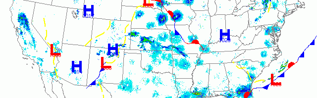
National overview
It might be easier to discuss where migration didn’t occur last night rather than where it did, given how widespread it was over the country. High pressure over New England, the Ohio Valley and the Great Basin kept birds down last night, while a series of low pressure systems and associated fronts triggered migration along both coasts and especially up the Central Flyway into the Upper Midwest.

Below are the radar loops from sunset last night through 5:00am (central time) this morning
Upper Midwest
Minnesota
Frames are every 1/2 hour. click on the thumbnail to view the full-sized animation.


Migration was evident over both the Twin Cities and Duluth radars last night but in both cases some heavy precipitation came through and knocked birds down well before daybreak. Migration was heaviest over the Twin Cities (many returns at 25 dBZ) while over Duluth most of the returns were in the 15-20 dBZ range. Therefore I expect that more of the new spring arrivals to occur through the middle of the state, while the north should pick up fewer new birds today and will have to wait for the weekend to see any wholesale change in bird composition. Either way more FOS birds will be found across Minnesota today.
Wisconsin
Frames are every 1/2 hour. click on the thumbnail to view the full-sized animation.


Migration conditions were best in the western part of the forecast area, mostly over Minnesota, therefore migration was light over Wisconsin. Birds were moving over all three of the radars but returns were only in the 10-15 dBZ range and pretty diffuse. Wisconsin birders throughout the state should see some new birds today but they Yellow-rump Warbler/ Ruby-crowned Kinglet fallout from the last two days should have dissipated across the landscape by this morning. No major concentrations can be deciphered from the radar today so hit those tried and true spring hotspots for your best bet at diversity and density today.
Iowa & Illinois
Frames are every 1/2 hour. click on the thumbnail to view the full-sized animation.


Again, with migration being heaviest to the west, IA and IL were under the same conditions as Wisconsin. See above for general interpretation.
As always, woodcreeper.com depends on you to report your sightings and be our ‘eyes on the ground’, so please come back and give us an idea of how we’re doing predicting birding conditions in your neck of the woods.
Good Birding,
David
For migration updates in other regions check-
Michigan’s Upper Peninsula -Â The Northwoods BIRDARÂ by Max Henschell
New England -Â Tom Auer’s blog
Florida/SE - Badbirdz Reloaded by Angel and Mariel Abreu
PA/Ohio Valley - Nemesis Bird by Drew Weber
NW Ohio - Birding the Crane Creek by Kenn Kaufman
Pac NW - Birds Over Portland by Greg Haworth
Continental US - eBird BirdCast Forecast & Report by Team eBird