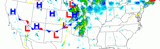
National overview
Migration activity was highest across the northern tier of states from the Great Lakes to New England last night, while birds were still on the move from South Texas up through the Central U.S. along the latest frontal boundary. Fallout conditions are possible along the frontal boundary, especially along the Lake Michigan shoreline of Wisconsin this morning. Lighter migration was also evident up through the Desert Southwest, along the Central Valley of California, and up into the Pacific Northwest.

Below are the radar loops from sunset last night through 5:00am (central time) this morning
Upper Midwest
Minnesota
Frames are every 1/2 hour. click on the thumbnail to view the full-sized animation.


Minnesota was within the line of storms as night arrived to the region, but enough clearing had occurred across the Twin Cities and Duluth to allow for heavy migration into and out of the area. Migration was on a S->N trajectory with a slight push to the east which will favor sites along the Lake Superior shoreline (including the north shore) this morning. With migration as heavy as it was, it behooves local birders to head out this morning to see what’s around.
Wisconsin
Frames are every 1/2 hour. click on the thumbnail to view the full-sized animation.


Wisconsin experienced both heavy precipitation and migration last night, which has the potential to cause some heavy fallout, especially along the Lake Michigan shoreline this morning. All three radars showed moderate to heavy migration last night with birds moving SW->NE across the state. Storms moving into eastern WI early this morning pressed birds against the Lake Michigan shoreline and up into the Door Peninsula. Birders from Green Bay to near Chicago, IL should be on alert for fallout conditions in their lakeshore haunts this morning. Birders throughout the interior should see some changing of the guard this morning as well, although birds will be more dispersed across the landscape. For inland birders, hit the tried and true spring migration hotspots, such as Pheasant Branch Conservancy in Middleton, for the best chance at high density and diversity. Birders along the southern border should see below for details on fallout potential.
Iowa & Illinois
Frames are every 1/2 hour. click on the thumbnail to view the full-sized animation.


Northern IA and IL were south of the main brunt of the storm last night, which meant that birds migrating over these regions were doing so into the storm. Birders in northern IA (and southern WI) who experienced heavy precipitation between 2am and sunrise should check out their local patch this morning for some possible fallout. Birders around Chicago should head to the lakeshore as birds were pushed east throughout the early morning hours (see Wisconsin above).
As always, woodcreeper.com depends on you to report your sightings and be our ‘eyes on the ground’, so please come back and give us an idea of how we’re doing predicting birding conditions in your neck of the woods.
Good Birding,
David
For migration updates in other regions check-
Michigan’s Upper Peninsula -Â The Northwoods BIRDARÂ by Max Henschell
New England -Â Tom Auer’s blog
Florida/SE - Badbirdz Reloaded by Angel and Mariel Abreu
PA/Ohio Valley - Nemesis Bird by Drew Weber
NW Ohio - Birding the Crane Creek by Kenn Kaufman
Pac NW - Birds Over Portland by Greg Haworth
Continental US - eBird BirdCast Forecast & Report by Team eBird
2 responses to “Late May riders on the storm”
Oh man, we are going to be a day late and a dollar short! tell them to stick around til tomorrow 🙂
Trying to get a discussion going on the site regarding “birds on radar” from wisb emails. Great discussions and highly informative.
Thanks Dave for the info