-
Fronts stacked up and filled with birds
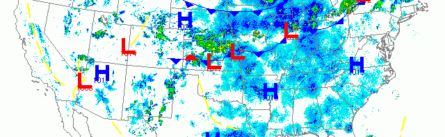
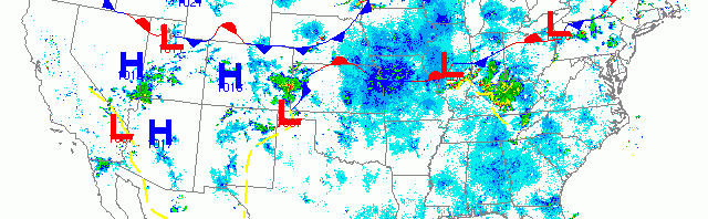
Check out the three fronts stacked up across the Midwest! And between each cookie layer there’s a heaping filling of sweet migrant goodness. Migration was heaviest across the Upper Midwest and down through the Central U.S. with only the Northeastern U.S. neglected due to poor conditions last night. That will change as these fronts move through and cooler air brings birds down from the Boreal breeding grounds over the next few days. Fallout potential is best along the precipitous frontal boundaries while otherwise widespread movement will bring new birds to migrant traps across the U.S. this morning. No time to do the individual radars today, so go ahead and take a stab at them yourselves; besides, you all know what you’re doing by now!!! 🙂
-
Birds behind the front
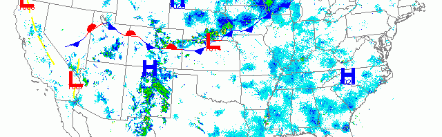
cold front draped across the country from Nevada to the Ottawa, Canada marked the southern boundary of moderate to heavy migration down into the midsection of the U.S. this morning. High pressure over the Southeastern U.S. also allowed birds to move south but migration densities were much more diffuse. Migration was also evident across the western U.S. all the way to the Pacific Coast. Birders along the aforementioned front this morning should be on the lookout for high densities of birds locally.
-
Migration in full swing
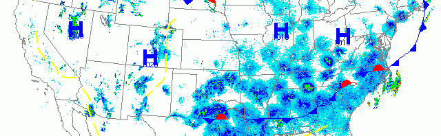
Conditions across the U.S. continue to favor nocturnal migration in all but a few locales. A frontal system draped across the Atlantic did cut off Peninsular Florida from the bulk of incoming migrants, but otherwise birds were moving in moderate to high densities from New England to Texas, and from Arizona to the Pacific Northwest. The Upper Midwest and Appalachian regions appeared to have the highest densities of migrants moving last night.
-
Widespread migration continues across U.S.
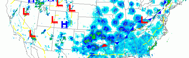
As the latest cold front marches across the U.S., birds took to the sky once more last night. My computer is on its last legs and is taking forever to download and process the data, so I’m very short on time this morning. Here’s the radar for your interpretation!
-
Birds birds birds
The national synoptic map is full of weak frontal systems creating a hodgepodge of lackluster weather events. This translates to migration conditions across the country ranging from mediocre to optimal. It’s worth checking out the loop from yesterday afternoon through current time on Paul Hurtado’s NEXRAD archive here. Migration was heaviest in the center of the country, sandwiched by two stationary fronts. Also heavy was the migration over the Upper Midwest, northwest of the stationary front, where winds were more northwesterly and favorable. Migration was evident from coast to coast with some of the heaviest migration of the season so far for the Western U.S. The Northeastern U.S. and New England experienced the least migration with suboptimal conditions in terms of winds and atmospheric disturbance prevailing.